| Instrument | Status/
Accuracy | Instrument Description | Measurement Technology | Timeline |
| C-Band SAR | Operational | Marine core services, land monitoring and emergency services. Monitoring sea ice zones and arctic environment. Surveillance of marine environment, monitoring land surface motion risks, mapping of land surfaces (forest, water and soil, agriculture), mapping in support of humanitarian aid in crisis situations. | n/a | 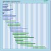 |
| CSG SAR | Operational | All-weather images of ocean, land and ice for monitoring of land surface processes, ice, environmental monitoring, risk management, environmental resources, maritime management, Earth topographic mapping. | n/a | |
| L-band SAR (NISAR) | Operational | 3-year mission to study solid earth deformation (earthquakes, volcanoes, landslides), changes in ice (glaciers, sea ice) and changes in vegetation biomass | n/a | |
| OLI | Operational | Measures surface radiance, land cover state, and change (e.g., vegetation type). Used as multi-purpose imagery for land applications. | n/a | |
| OLI-2 | Operational | Measures surface radiance, land cover state, and change (e.g., vegetation type). Used as multi-purpose imagery for land applications. | n/a | |
| PALSAR-2 | Operational | Disaster monitoring, land monitoring, agricultural monitoring, natural resource exploration, global forest monitoring, potential use and interferometry. | n/a | |
| PALSAR-3 | Operational | Disaster monitoring, land monitoring, agricultural monitoring, natural resource exploration, global forest monitoring, potential use and interferometry. | n/a | |
| PAZ SAR-X | Operational | High resolution X-band radar for security, land use, urban management, environmental monitoring, risk management. Spotlight, Scansar and Stripmap acquisition modes. | n/a | |
| SAR (RADARSAT-2) | Operational | All-weather images of ocean, ice and land surfaces. Used for monitoring of coastal zones, polar ice, sea ice, sea state, geological features, vegetation and land surface processes. | n/a | |
| SAR (RCM) | Operational | All-weather, C-band data to support ecosystem monitoring, maritime surveillance and disaster management. | n/a | |
| SAR 2000 | Operational | All-weather images of ocean, land and ice for monitoring of land surface processes, ice, environmental monitoring, risk management, environmental resources, maritime management, Earth topographic mapping. | n/a | |
| SAR-L | Operational | Land, ocean, emergencies, soil moisture, interferometry, others. | n/a | |
| WSAR | Operational | High resolution radar measurements of land and ocean features. | n/a | |
| X-Band SAR | Operational | High resolution images for monitoring of land surface and coastal processes and for agricultural, geological and hydrological applications. | n/a | |
| L-Band SAR | Approved | L-band SAR instrument combining wide swath, high spatial resolution, high sensitivity, low ambiguity ratios, full polarimetric acquisition capability, and repeat-pass interferometry to support the retrieval of surface deformation over vegetated terrain, above-ground biomass density, soil moisture, land cover and land-cover change, flooded area information, ice sheet and glacier velocity, snow water, sea-ice conditions (type, concentration and motion), ocean winds and sea state conditions, as well as enhancing European maritime situational awareness. | n/a | |
| LTI | Approved | The aim of MAGIC is to obtain high-resolution measurements in space and time and include the capability to determine the variations in gravity field due to mass change in hydrology, cryosphere, oceanography, solid Earth and climate change signals so as to serve science and operational products including emergency services. | n/a | |
| Multiview Thermal-Infared | Approved | Observations of motion occurring at or near Earth’s surface. | n/a | |
| NG C-Band SAR | Approved | Marine core services, land monitoring and emergency services. Monitoring sea ice zones and arctic environment. Surveillance of marine environment, monitoring land surface motion risks, mapping of land surfaces (forest, water and soil, agriculture), mapping in support of humanitarian aid in crisis situations. | n/a | |
| Passive Synthetic Aperture Radar | Approved | High-resolution observations of motion occurring at or near Earth’s surface. Record radio waves originating from the accompanying Copernicus Sentinel-1 satellite as they bounce back from the Earth’s surface, allowing scientists to measure small shifts in the shape of the land surface, such as those related to earthquakes and volcanic activity, as well as of land ice and sea ice. | n/a | |
| LandIS | Proposed | Measures surface radiance, land cover state and change (e.g., vegetation type), and longwave termal infrared surface emittance. Used as multi-purpose imagery for land applications. | n/a | |