GREENHOUSE GAS SATELLITE MISSIONS PORTAL
Updated for 2026
Greenhouse Gas Satellite Missions Portal
This Portal aims to provide a comprehensive and up-to-date list of all current and planned satellite missions with the ability to measure greenhouse gases. This includes those planned and operated by both public and commercial organisations, as well as NGOs. The Portal is based on data from the CEOS MIM Database and aims to support the analysis and planning of GHG measurement continuity by providing visualisation and export capabilities such as measurement timelines and tables of missions and instruments. The CEOS Database team will undertake to ensure the Portal is both comprehensive and current so that it may be applied with confidence for these studies.Missions are categorised under three headings according to their purpose and capabilities.
The Portal aims to support coordination and planning of initiatives world-wide that are seeking to exploit these valuable data in support of emission reduction measures. It should assist those researching which data sources may be suitable for their information needs and can provide a basis for the high-level coordination needed among space agencies and other data providers to ensure that society has continuity of these key measurements into the future in support of our long-term climate data records and processes such as the Global Stocktake of the Paris Agreement.
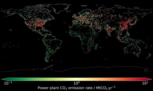
At the heart of the Paris Agreement is an understanding that governments will develop and meet GHG emission reduction targets. The global community recognises the need for urgent and collective actions on the mitigation of GHG emissions if we are to limit global warming. Data and knowledge of global GHG emissions, trends and sources will become increasingly important to support national and international climate policymaking. Transparent reporting processes will demand more and better data to satisfy society's needs, and satellite Earth observation (EO) has the potential to play a critical role to support policymakers at the intersection between science and action. EO satellites are increasingly capable of monitoring GHG emissions with precision, accuracy, resolution, and coverage needed to support policymakers at all levels, from the sub-national and national level for the establishment and operation of national GHG inventories, through to the global reconciliation and accounting processes that will seek to match aggregated national reports with the latest global observations. Refer to the CEOS Global Stocktake Portal for more information on relevant datasets.
The GHG Constellation Builder linked below has been created to help users identify a constellation of satellites which meets their specific requirements. Simply make a copy of the spreadsheet and use the filters to tailor a solution.
This resource is a product of the overall Greenhouse Gas Roadmap being implemented by CEOS and CGMS agencies.
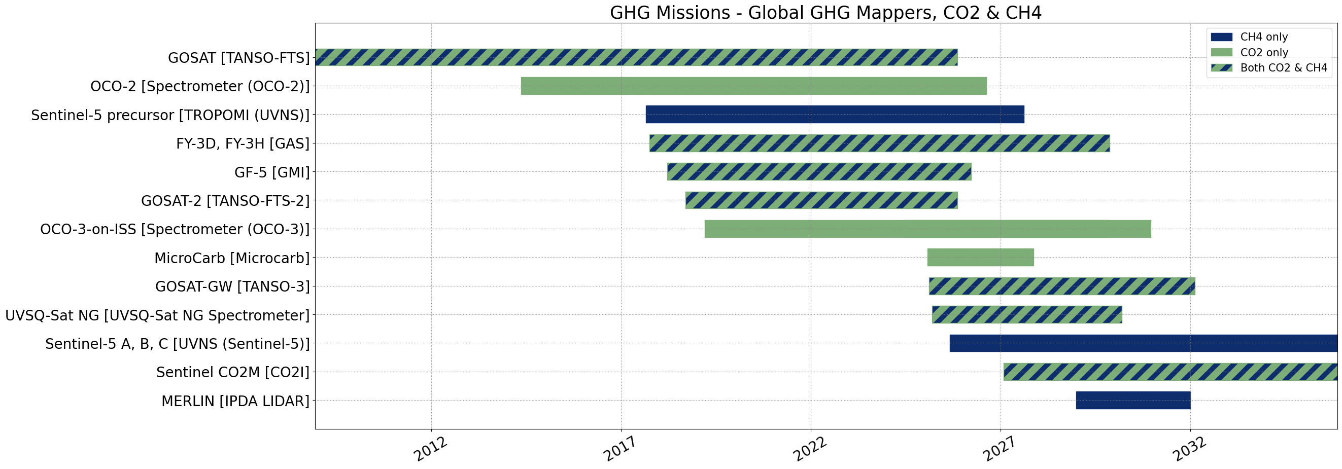
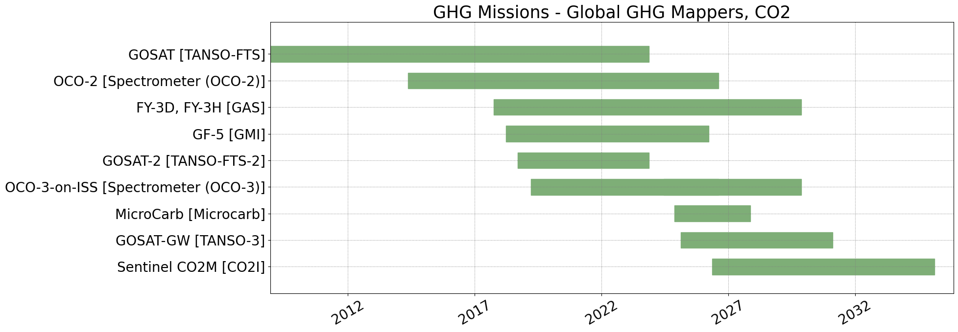
GHG Mission Timelines
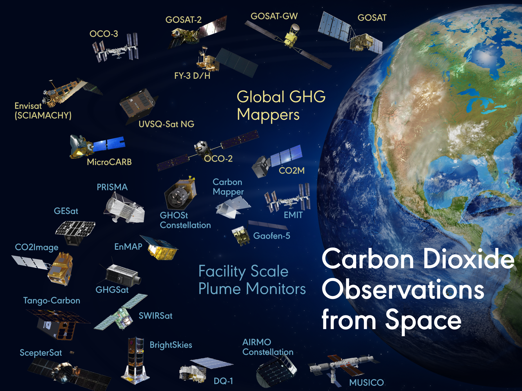
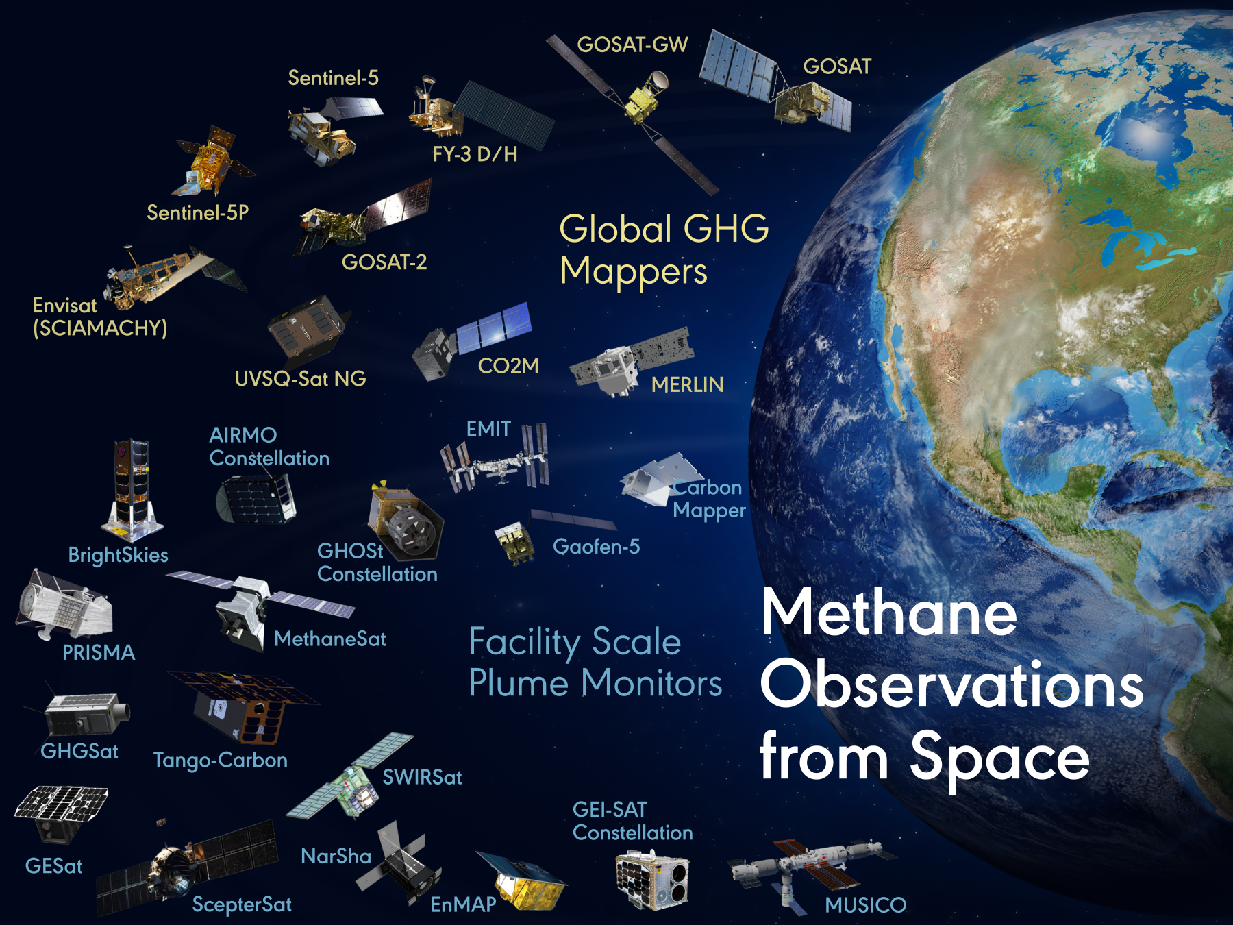
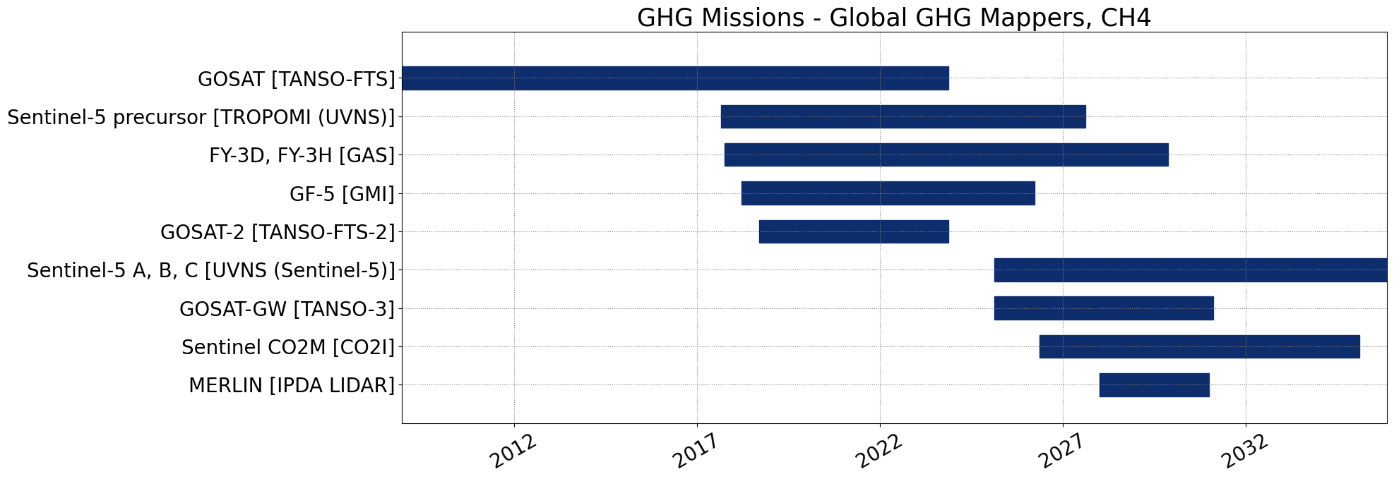
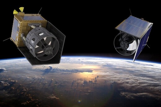
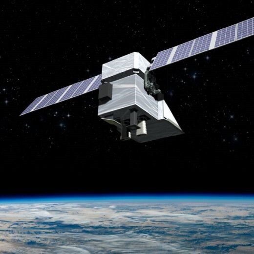
Global GHG Mappers
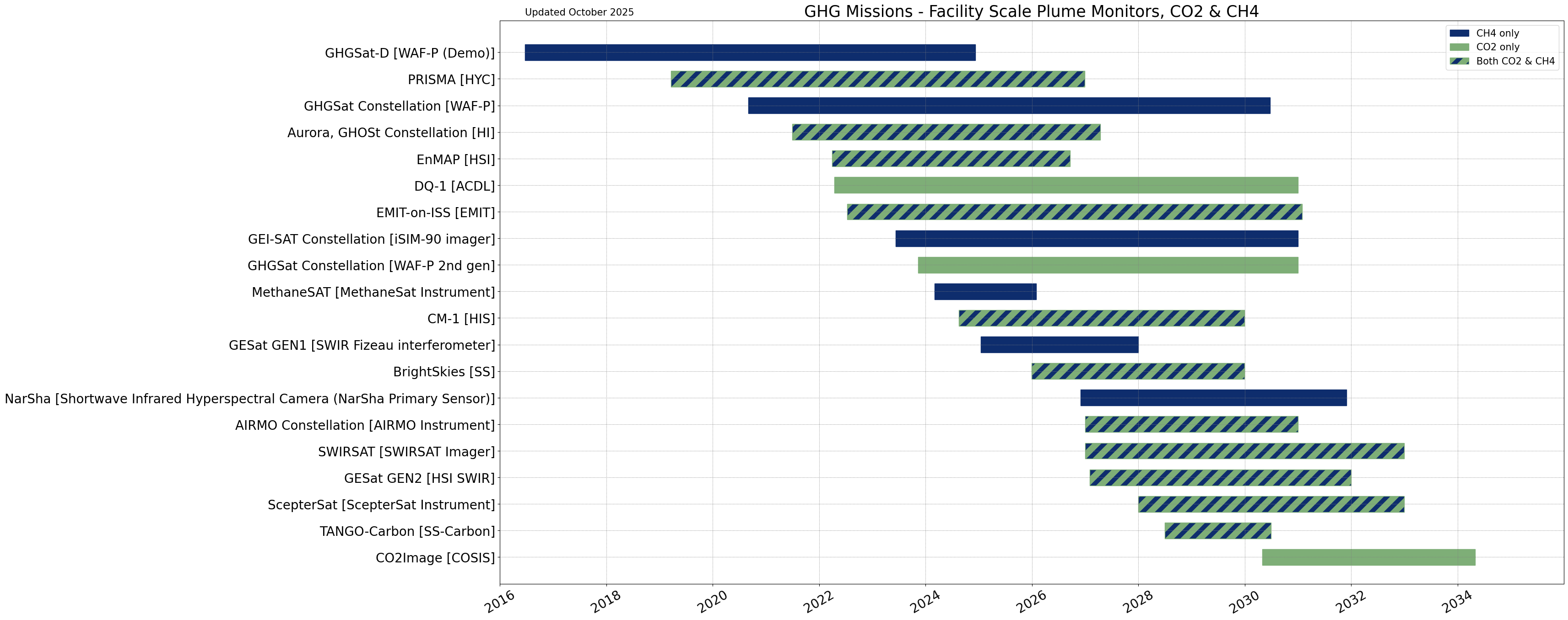
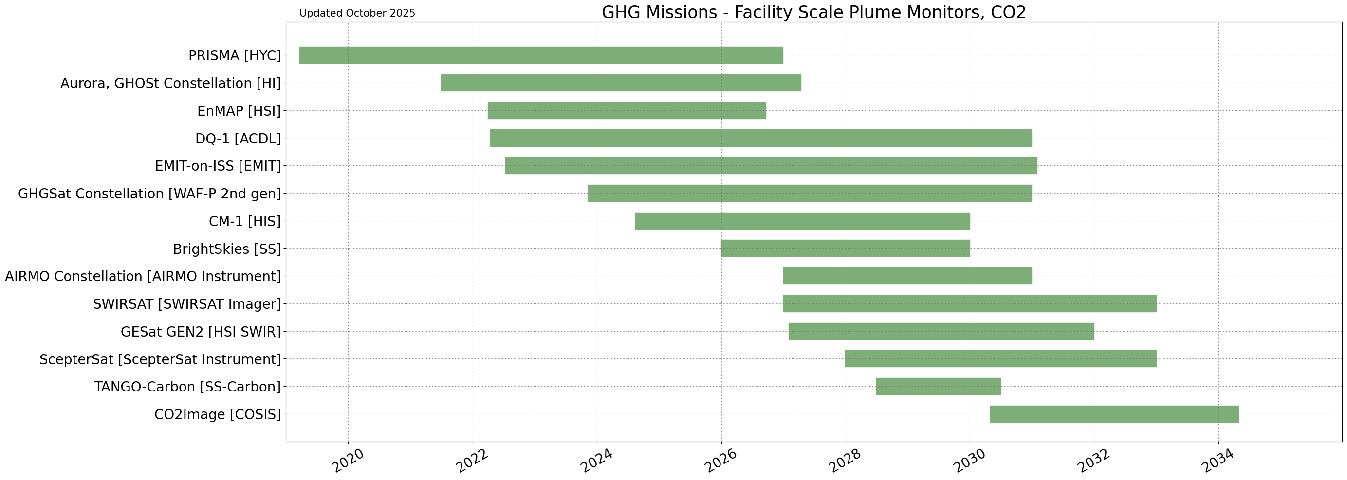
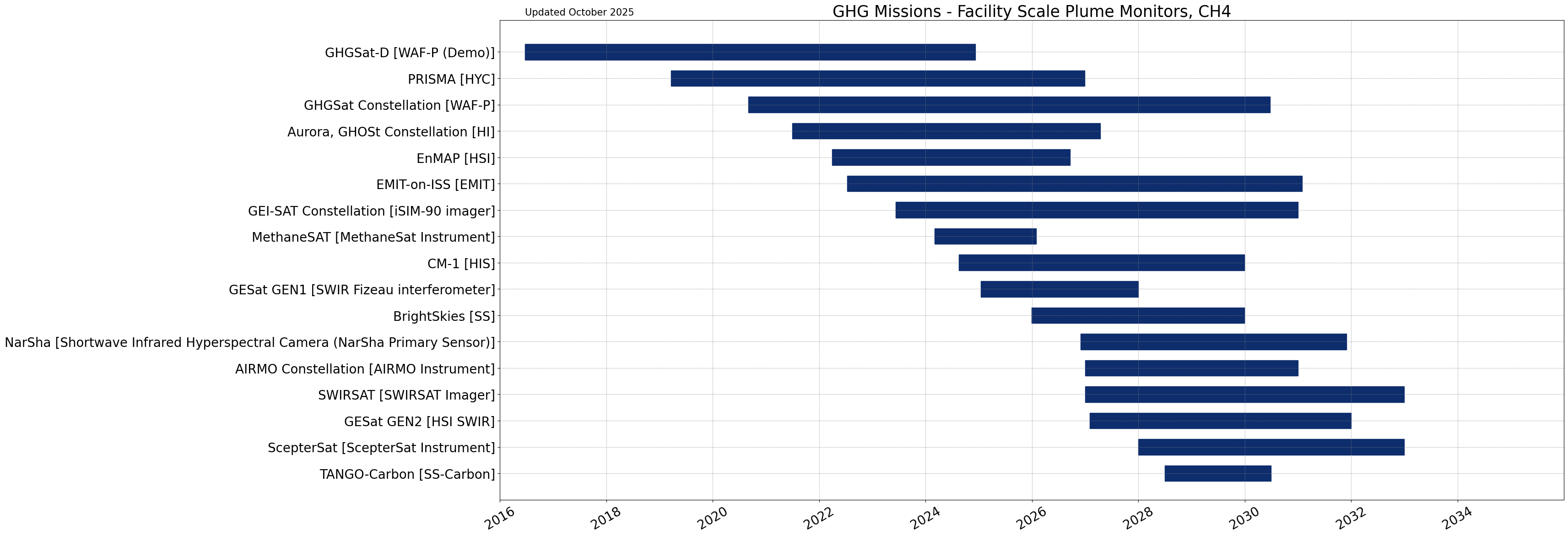
Facility Scale Plume Monitors
Global GHG Mappers
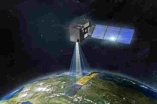
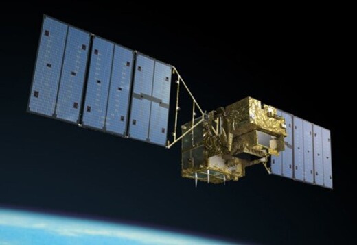
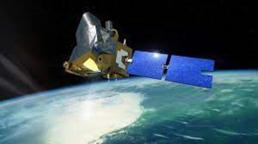
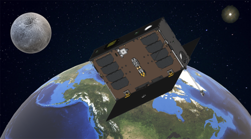
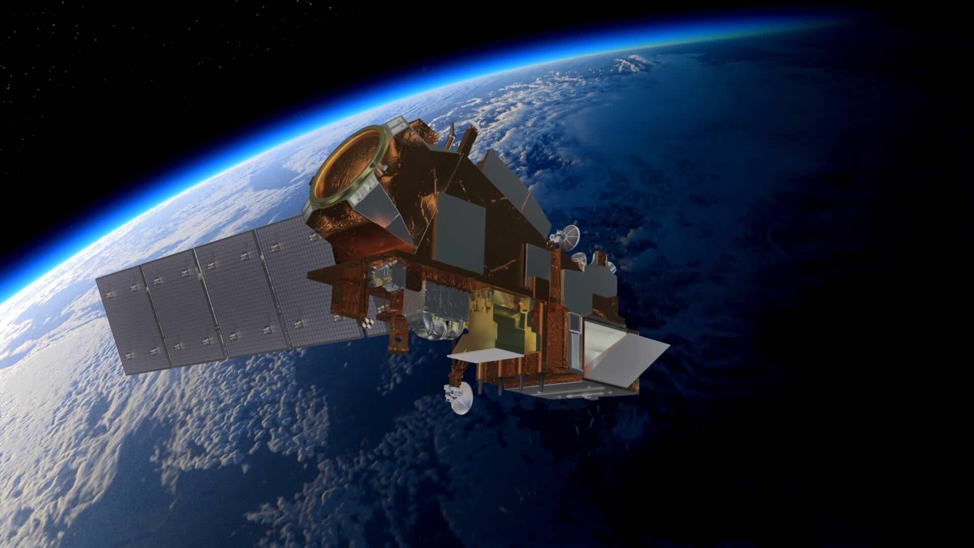
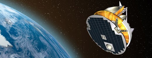
CO2M
The Copernicus CO2M mission measures human-induced carbon dioxide and methane emissions. It deploys satellites to reduce uncertainties in fossil fuel combustion estimates at national and regional levels, offering an independent information source for policy assessment and tracking Europe's decarbonisation progress and emission reduction goals. More...
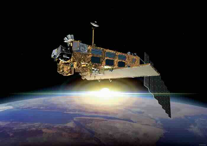
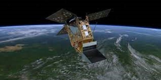
Envisat (SCIAMACHY)
The SCanning Imaging Absorption spectroMeter for Atmospheric CartograpHY (SCIAMACHY) was an advanced imaging spectrometer on board the Envisat satellite mission. Operating from 2002-2012, the instrument provided tropospheric and stratospheric profiles of trace atmospheric gases, including CH4 and CO2. More...
FengYun-3D
FengYun-3D is an operational meteorology mission, playing a significant role in ocean and ice monitoring, climate monitoring, atmospheric chemistry, and space weather. It retrieves greenhouse gases (GHGs) such as CH4, CO2, and other atmospheric gases. More...
FengYun-3H
FengYun-3H, the 7th flight unit of the FY-3 series, is dedicated to operational meteorology and will contribute significantly to ocean and ice monitoring, climate monitoring, atmospheric chemistry, and space weather. It will also measure concentration distributions of major greenhouse gases (CO2, CH4, etc.) in the global atmosphere. More...
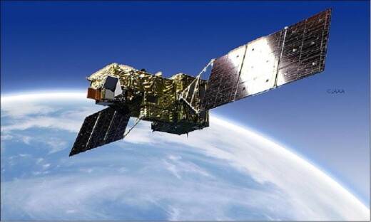
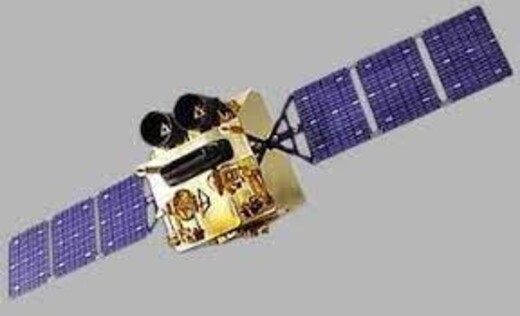
GOSAT
The GOSAT mission aims to monitor the global distribution of greenhouse gases (GHGs), including CO2 and CH4, at a subcontinental scale. Its goal is to verify the effectiveness of GHG emission reduction measures and contribute to understanding and addressing climate change challenges. More...
GOSAT-2
The GOSAT-2 mission aims to extend the GHG monitoring record initiated by GOSAT. Its goal is to measure the global distribution of greenhouse gases (GHGs) such as CO2 and CH4 at a subcontinental scale, verifying the effectiveness of GHG emission reduction efforts. More...
GOSAT-GW
The mission's goal is to monitor Greenhouse gases (GHGs) like carbon dioxide and methane in the atmosphere, aiding in understanding climate change rates. Additionally, it seeks to enhance our understanding of the water cycle, which plays a crucial role in Numerical Weather Prediction (NWP) and climate modeling. More...
MERLIN
The MERLIN mission aims to achieve high precision and accuracy in obtaining spatial and temporal gradients of atmospheric CH4 columns on a global scale. It seeks to enhance knowledge of both natural and anthropogenic CH4 emissions, contributing to better understanding and monitoring of greenhouse gas dynamics and their impact on the environment. More...
MicroCARB
The MicroCARB mission aims to globally map CO2 sources and sinks, as well as fluxes between the atmosphere, oceans, and vegetation. It plays a critical role in understanding carbon cycles and helps monitor the impact of natural and human activities on greenhouse gas dynamics. More...
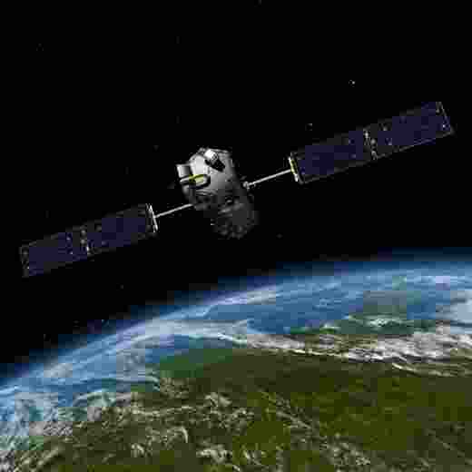
OCO-2
The mission aims to obtain high-resolution CO2 measurements, characterising sources and sinks regionally and quantifying their seasonal variability. Its application enhances understanding of surface CO2 sources and sinks, identifying regional differences between geographic areas. More...
OCO-3
The mission aims to acquire high-resolution CO2 measurements, characterising sources and sinks regionally with seasonal variability. Its application includes objectives like OCO-2, understanding fossil fuel plumes across North America, Europe, and Asia, and studying anthropogenic emissions in megacities. More...
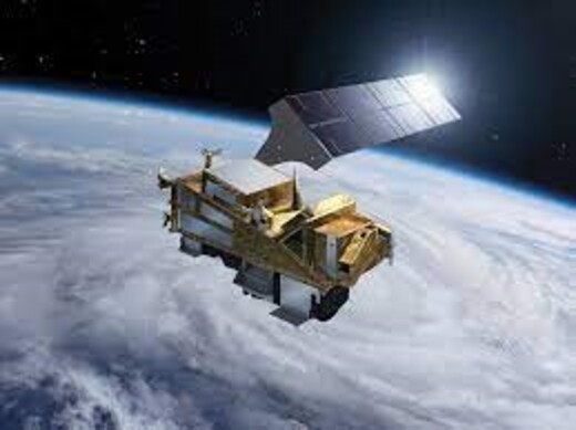
Sentinel-5
The Sentinel-5 mission will conduct daily atmospheric measurements, monitoring global coverage for air quality, climate forcing, ozone, and UV radiation. It will also track GHG emissions like CH4, as well as their tracers and aerosols, relevant to climate forcing on a global scale. More...
Sentinel-5P
The Sentinel-5P mission conducts high-resolution atmospheric measurements daily, contributing to air quality, ozone, UV radiation, climate monitoring, and forecasting. It specifically monitors GHGs, including CH4, their tracers, and aerosols with relevance to global climate forcing. More...
UVSQ-Sat NG
UVSQ-Sat NG objectives include ensuring continuity of the Earth Radiation Budget (ERB) initiated via the UVSQ-Sat and Inspire-Sat satellites, achieving broadband ERB measurements, and conducting precise and comprehensive monitoring of atmospheric gas concentrations (CH4, CO2) on a global scale. More...
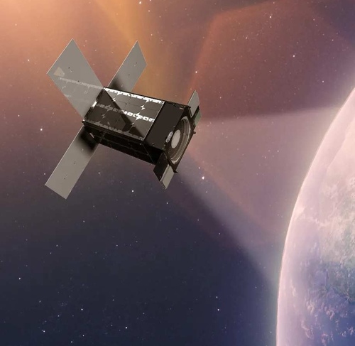
Facility Scale Plume Monitors

Airmo Constellation
The mission aims to monitor diverse and remote locations for GHG emissions, especially CH4. By 2030, it seeks to identify all super emitters, particularly within the Oil & Gas industry, contributing to improved greenhouse gas monitoring efforts. More...
Aurora
The Aurora mission is a precursor to GHOSt, capturing 450 spectral bands from visible to shortwave infrared. This advanced capability observes key greenhouse gases (GHGs) like CO2, CH4, N2O, and more, enhancing greenhouse gas monitoring efforts. More...

Brightskies
The Brightskies mission employs hyperspectral observations to track environmental impacts, water quality, and atmospheric changes. Its application involves measuring carbon dioxide and methane in the troposphere and understanding the source and sink processes affecting these greenhouse gases (GHGs), contributing to our understanding of climate dynamics and environmental changes. More...
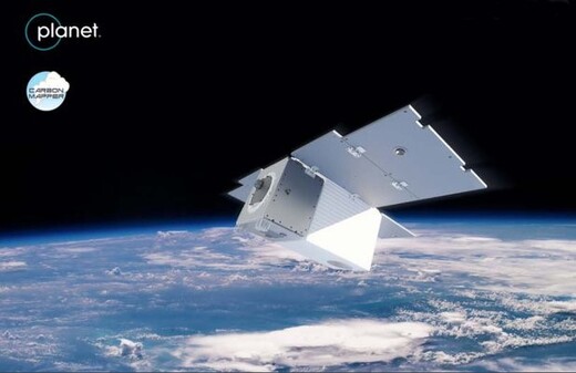
Carbon Mapper
The mission's goal is to pinpoint, quantify, and monitor CH4 and CO2 emissions at individual facility scales, promoting global accessibility and transparency of methane and CO2 data. The application includes fast methane leak detection for facility operators and regulators, aiding in certifying methane intensity for oil and gas supply chains. More...
CO2Image
The mission goal of CO2Image is to precisely measure trace gas emissions at a high spatial resolution, offering valuable insights into greenhouse gas dynamics and their impact on the environment. By providing accurate data, it aids in understanding and addressing climate change challenges effectively. More...
DQ-1
DQ-1 is the first spaceborne lidar capable of measuring CO2, with expected accuracy better than 1 ppm. The mission is a follow-on to the GF-5 series. More...
EMIT
EMIT's mission goal is to fill the crucial gap in dust source information, enabling scientists to create a comprehensive mineral map of Earth's dust-producing regions. By providing this missing data, EMIT supports better understanding and management of dust-related environmental impacts and atmospheric processes. More...
EnMAP
The EnMAP mission aims to measure, derive, and analyse essential parameters for Earth's surface, including agriculture, forestry, soil, geology, coastal zones, and inland waters. It assesses ecosystem status and responses to environmental changes, aiding carbon emissions accounting and monitoring land surface changes like forest degradation and deforestation. More...
Gaofen-5
Gaofen-5 is a hyperspectral mission that observes Earth's environments, tracking environmental impacts, water quality, and atmospheric changes. It measures carbon dioxide and methane in the troposphere to understand the processes affecting these greenhouse gases (GHGs). More...
GESat
The GESat missions aim to deliver facility-scale measurements of GHG emissions worldwide, with the possibility of fast retasking and cueing global mapping detection at a fine spatial resolution. GESat GEN1 will measure CH4 with a SWIR Fizeau interferometer, while GEN2 will measure both CH4 and CO2 with a hyperspectral imager. More...
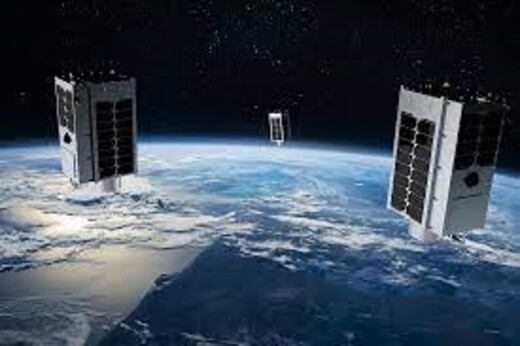
GEI-SAT Constellation
As part of a dedicated constellation, GEI-SAT will aim to provide near-continuous coverage of any sub-polar point on the globe (during daytime hours) to identify CH4 emission sources. This high-frequency monitoring enhances our ability to understand and mitigate methane emissions impact on climate change and the environment. More...

GEI-SAT Precursor
GEI-SAT's main goal is high-resolution CH4 measurements and geolocation of emitters to quantify methane emissions in Oil & Gas. As part of a dedicated constellation, it provides near-continuous sub-polar coverage during daylight. Combined with VNIR and SWIR observations, it accurately identifies CH4 emission sources globally. More...
GHGSat-C
The GHGSat-C series of satellites optimally measures CH4 from point sources and localised areas. It offers insights into industrial CH4 emissions, aiding industrial operations and policy development. In-orbit measurements of controlled CH4 releases validate instrument performance. GHGSat C-10 measures CO2 emissions, while the other satellites in the constellation measure CH4 only. More...
GHOSt Constellation
The GHOSt satellite constellation builds on the Aurora mission, capturing data with enhanced 8-meter spatial resolution across the same spectral bands. It serves multiple sectors, like energy, mining, and defense, supporting tasks such as pipeline monitoring, methane mapping, clean-energy exploration, sustainable mining practices, and wildfire risk mitigation. More...
MethaneSAT
MethaneSAT aims to detect high-emitting point sources with broader swath coverage, enabling frequent revisits for robust emission quantification. It monitors regions responsible for 80% of global oil and gas production, quantifying emissions rates and facilitating tracking changes over time. Its applications will be significant in the oil and gas and agriculture sectors. More...
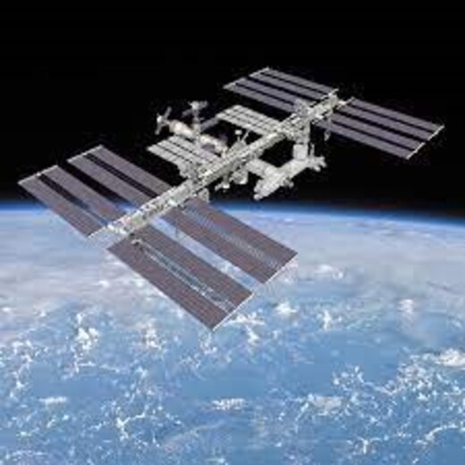
MUSICO
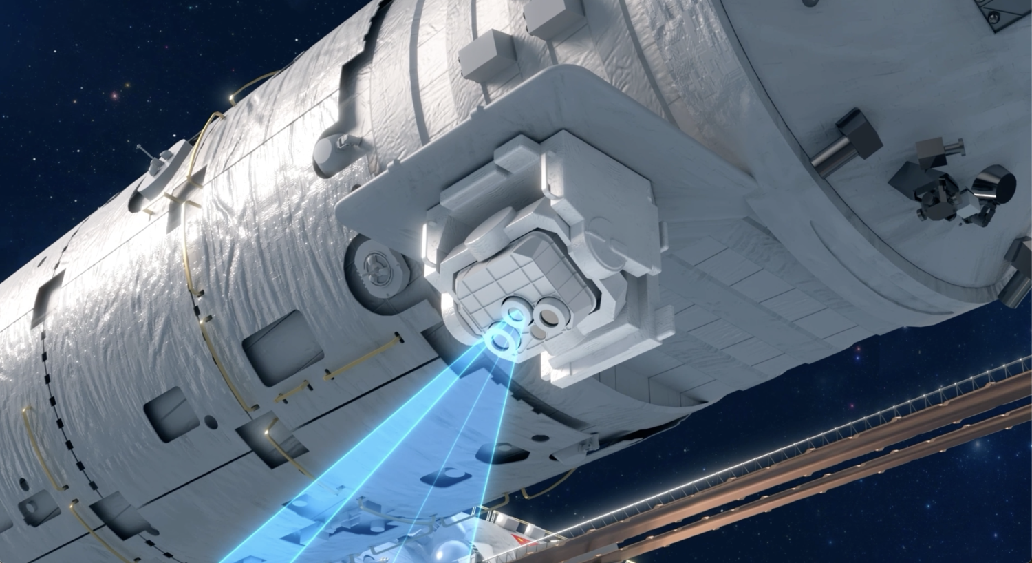
The Multi-Spectral Imaging Carbon Observatory (MUSICO) is a lightweight, high-resolution high-precision carbon dioxide (CO2) and methane (CH4) point source synergistic detection payload onboard the Tiangong Space Station. More...
NarSha
NarSha (Korean Methane Monitoring Microsatellite (K3M)) is a constellation of microsatellites aimed at local-scale monitoring of methane emissions and identification of emission sources. More...
PLATINO-HYPER (IRIDE)
PLATINO-HYPER, part of the IRIDE Programme, is a five satellite constellation providing very high spectral resolution imagery, enabling identification of spectral signatures and analysis of the chemical and physical properties of surfaces and materials. More...
PRISMA
The PRISMA mission aims to provide a global observation capability for monitoring natural resources and atmospheric characteristics. It specifically covers Europe and the Mediterranean region. The mission's application involves monitoring the carbon cycle and quantifying GHG emissions from various sources. More...
ScepterSat
ScepterSat utilises advanced hyperspectral sensors to observe emissions from point-source to regional scales, with a primary focus on various air-quality parameters, including major GHGs. Scepter has also developed, for regional station-keeping observing, ScepterHAPS, the first stratospheric balloon-borne spectrometer validated with customer data to detect CH4 below 20 kg methane per hour. More...
SWIRSAT
SWIRSAT carries a high spatial resolution multispectral imager, using short-wave infrared (SWIR) wavelengths for global monitoring of GHG concentrations, specifically CH4 and CO2. More...

TANGO-Carbon
The TANGO Carbon mission (TANGO-Carbon) monitors CH4 and CO2 emissions from industrial facilities and power plants. It complements Copernicus missions like Sentinel-5P and the CO2M High Priority Candidate Mission (HPCM), providing high-resolution, regular monitoring of major anthropogenic GHG emissions to enhance our understanding of greenhouse gas dynamics and their environmental impact. More...
Operational Sounders

Aqua
The Aqua mission's goal is to study Earth's interconnected processes and water cycle. It measures CO2 and CHM4 in the middle troposphere with AIRS, studying the atmosphere's response to greenhouse gases. More...
JPSS
The JPSS series (also known as NOAA-20 & 21) carry the CrIS instrument, which gathers information on GHGs, primarily in the middle and upper atmosphere. More...
Metop-B
The Metop-B mission acquires diverse land, ocean, and atmospheric measurements, supporting operational services for nowcasting, weather forecasting, and climate applications. It profiles the middle atmosphere to monitor CO2, CH4, and N2O, derived from IASI measurements, contributing crucial data for climate and greenhouse gas monitoring efforts. More...
Metop-C
Metop-C is the third and final satellite of the first generation of Metop polar-orbiting meteorological satellites,following on from Metop-A and Metop-B. The mission acquires a wide range of land, ocean, and atmospheric measurements serving operational services for weather forecasting and climate. Metop-C provides observations of the global atmosphere, oceans and continents. Flying in low Earth orbit at an altitude of about 800 km, these polar-orbiting satellites are able to take images of our planet in unprecedented detail. It can monitor CO2, CH4, and N2O that are derived from IASI measurements. More...
Metop-Second Generation A1/A2/A3
The goal of Metop-Second Generation missions is to acquire diverse land, ocean, and atmospheric measurements, serving operational services for nowcasting, weather forecasting, air quality monitoring, and climate applications. These missions play a crucial role in enhancing our understanding of Earth's systems and improving weather and climate predictions. More...
SciSat-1
SciSat-1 monitors and analyses chemical processes that impact ozone distribution in the upper troposphere and stratosphere. It measures vertical resolutions of major greenhouse gases (GHGs) identified in the Paris Agreement for effective monitoring. More...
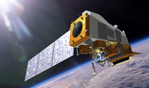
Suomi NPP
The mission aims to obtain diverse land, ocean, and atmospheric measurements to advance Earth system science and support operational weather forecasting. It covers clouds, oceans, vegetation, ice, solid Earth, and atmosphere. The application involves using the CrIS sensor to measure CO2 and CH4 concentrations in the middle troposphere. More...
Shortwave Infrared Capabilities
Case Studies
Satellite GHG Data Making an Impact
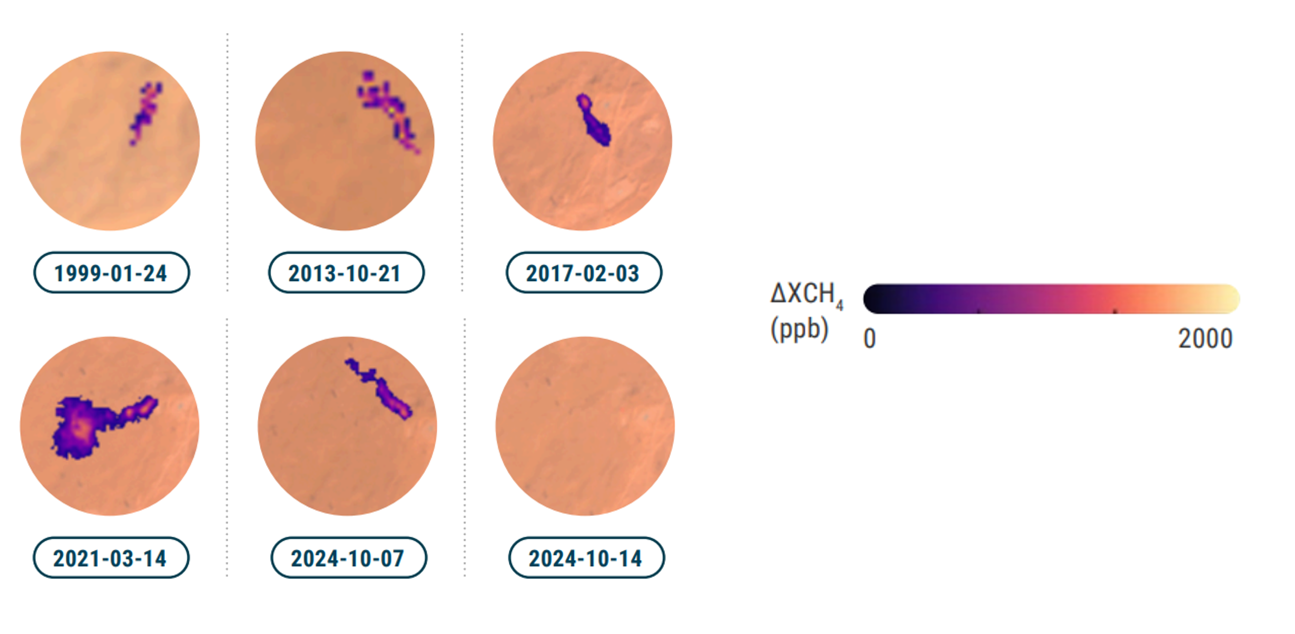
Reducing Emissions in AlgeriaCH4
The Hassi Messaoud oil field is known to be the largest and
oldest oil field in Algeria. In 2024, UNEP's International
Methane Emissions Observatory (IMEO) analyzed emissions
from an oil well where continuous emissions were detected. A
review of historical satellite data revealed the source was
emitting since at least 2013, when the earliest high-quality
satellite data is available from Landsat-8, with evidence of emissions at the
site
dating as far back as 1999 from observations via Landsat-5 data. Based on the
large number of images observed and the presence of a plume in every
high-quality image, it is highly
likely that the source was continuously emitting methane.
Read More...
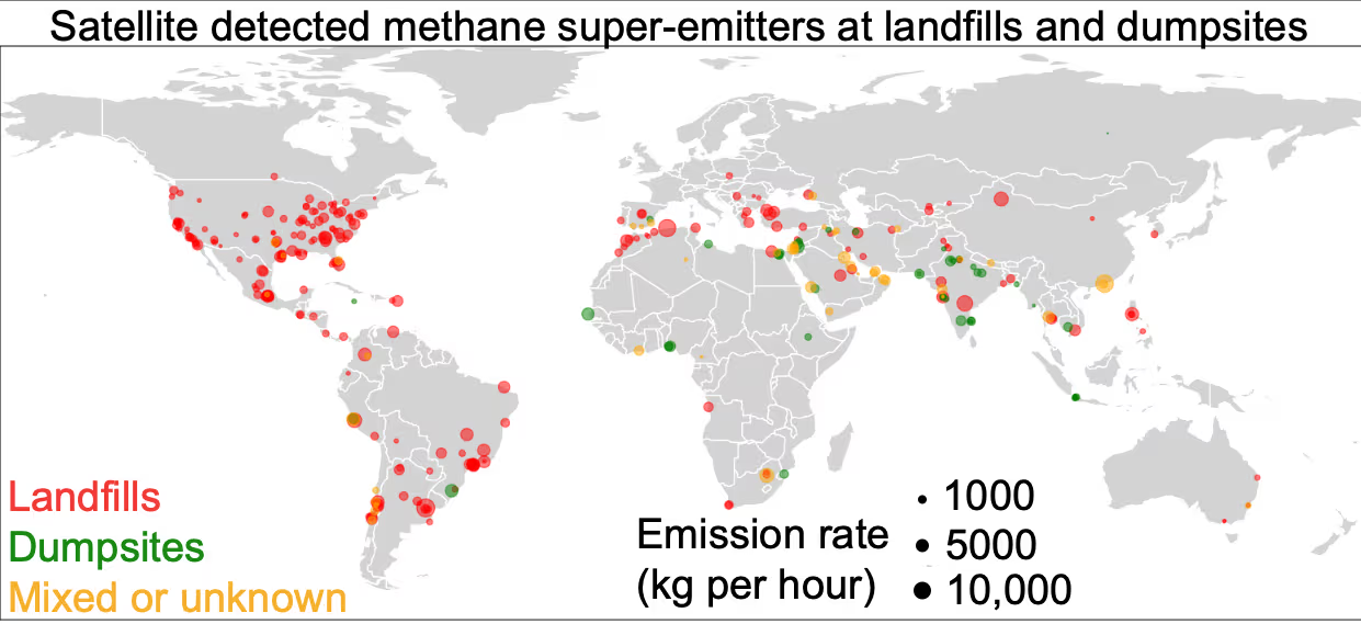
Carbon Mapper Revealed Landfill Super-emittersCH4
Waste sites have long been known to have high levels of methane emissions, and
are key areas where countries can introduce strategies to reduce their overall
greenhouse gas emissions. With Tanager-1 and EMIT data, Carbon Mapper surveyed
10,000 waste sites around the world, looking at their levels of methane
emissions. 371 landfills and dumpsites from 71 countries were identified as
emitting large amounts of methane, amounting to 6.1 million metric tons of
methane per year. This accounts for 9% of the global anthropogenic methane
emissions from the waste sector. For one site in Algeria, Carbon Mapper data
found that the emissions are almost two orders of magnitude larger than modelled
emissions.
Read More...
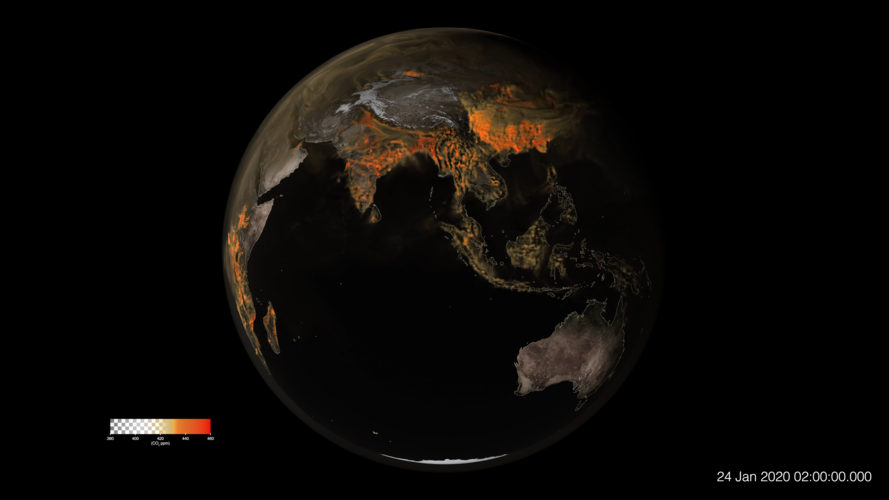
Observe Daily Pulses in CO2 EmissionsCO2
NASA's Earth Observatory presents a global model of
CO2 between January and March 2020, using data from MODIS and VIIRS
satellite instruments. Circulation of the Earth's atmosphere spreads these
CO2 emissions across the continents and oceans. The model was created
using NASA's Goddard Earth Observing System (GOES), a supercomputer-powered
weather model used to simulate atmospheric processes. GOES uses satellite data
including that from NASA's Terra and NOAA's Suomi-NPP satellites.
The map pulses daily due primarily to the diurnal behaviour of both
fires and plant life. Fires tend to flare up during daytime and die down at
night - and plants absorb CO2 during the day then release it during
the night.
The full CO2 visualisation can be downloaded from NASA's
visualisation studio.
Read More...
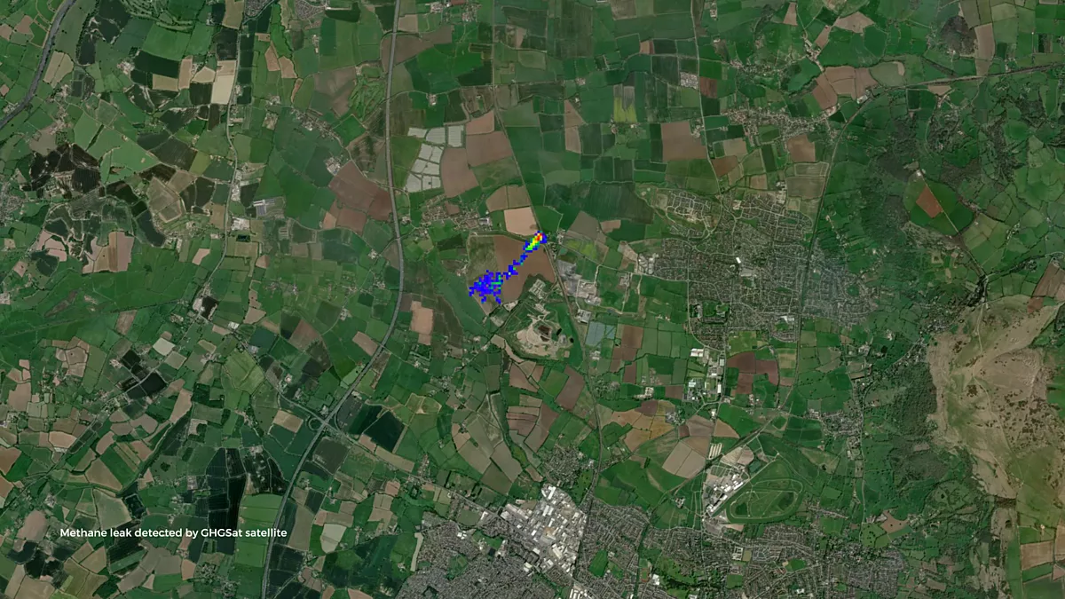
Pipe Leak in the UK Detected by GHGSatCH4
GHGSat satellites observed a methane plume over Cheltenham, UK,
originating from a pipe leak near a landfill site. Researchers from the UK's
National Centre for Earth Observation (NCEO) and the University of Leeds spotted
the emission while using GHGSat data in support of the UK DECC (Deriving
Emissions linked to Climate Change) Network.
GHGSat tasked their constellation to make five further measurements
which observed methane emission rates of between 200 and 1,400 kg per hour.
These observations were validated by in situ measurements and then used to
inform the attributor who promptly addressed the leak. This feat marked the
first time that methane emission in the UK had been detected from space and
mitigated.
Read More...
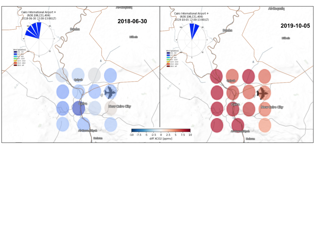
Cairo Farmlands Absorb CO2
CO2
JAXA's GOSAT mission monitored crops on farm lands surrounding
Cairo, Egypt consumed CO2 by observing solar-induced chlorophyll
fluorescence (SIF). SIF is an innovative measurement that serves as a proxy for
plant photosynthetic activity. Crops and other plants absorb sunlight during
photosynthesis, and emit some of the unused energy as a red glow, known as SIF.
Daily atmospheric CO2 changes can be monitored by
combining data from the GOSAT and Sentinel-5P satellites with surface wind data
and emission inventories. GOSAT observes partial column densities of
tropospheric carbon dioxide (XCO2) over cities and provides
CO2 enhancement between the lower and upper atmosphere.
The image shows that in the summer growing season, low
CO2 levels were detected over Cairo, correlated with high SIF.
Read More...
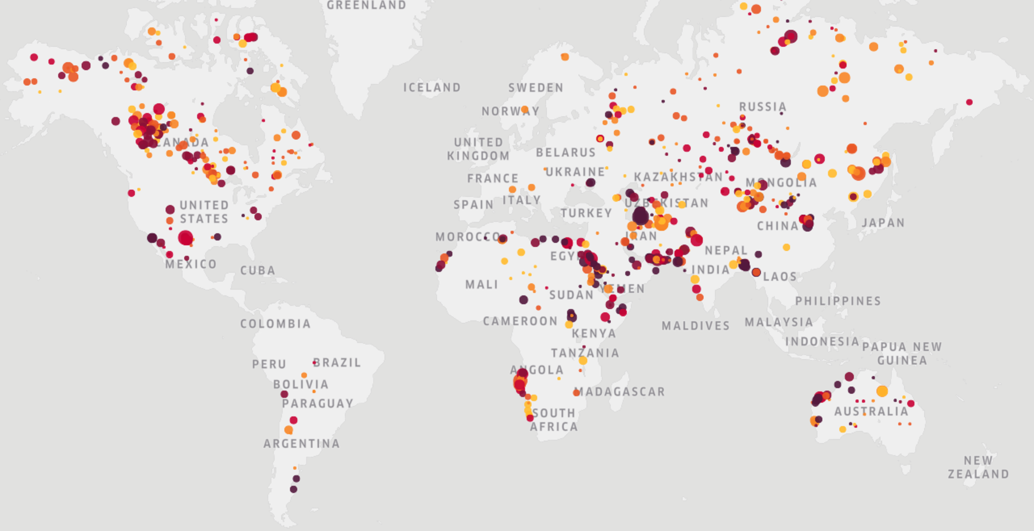
Global Methane Monitoring with KayrrosCH4
European company Kayrros has developed a global methane
monitoring tool that leverages data from the Sentinel-5P and EMIT missions, with
further data available from Sentinel-2 and -3, GOES-R, EnMAP, and PRISMA. The
tool features a time series of large methane emissions with asset and source
classification.
ESA's Sentinel-5P observations are supplemented by missions like
Sentinel-2 and -3 with higher resolution and narrower swaths, using the 'tip and
cue' measurement approach, which uses a facility scale plume monitor to hone in
on a GHG source as broadly identified by a wide area mapper.
Kayrros studies indicate that there are around 100 large methane
leaks at any time around the world, and approximately half of them are
attributable to the oil, gas and mining sectors.
Read More...
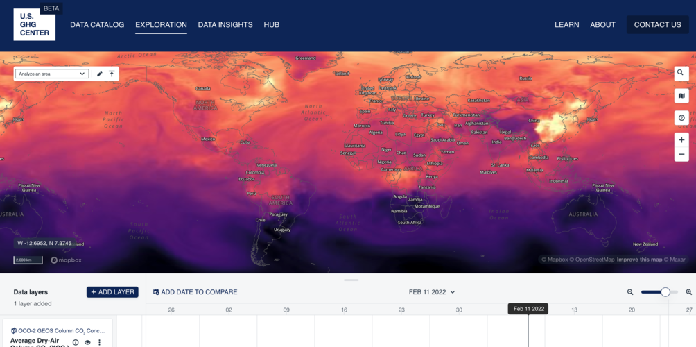
Explore Data with the US GHG CenterCO2
CH4
The U.S. GHG Centre Explorer showcases a global interactive map
of GHG emissions and fluxes. The platform offers public access to GHG datasets,
information, and analysis tools.
Data available through the explorer include air-sea CO2
flux, gridded anthropogenic CH4 emissions, GOSAT CH4
emissions, wetland CH4, MiCASA Land Carbon Flux, OCO-2 data, fossil
fuel CO2, world population density, and inverse CH4.
Read More...