Ocean topography/currents
Measurements
Measurements > Ocean > Ocean topography/currents Ocean surface topography data contain information that has significant practical applications in such fields as the study of worldwide weather and climate patterns, the monitoring of shoreline evolution and the protection of ocean fisheries. Ocean circulation is of critical importance to the Earth’s climate system. Ocean currents transport a significant amount of energy from the tropics towards the poles, leading to a moderation of the climate at high latitudes. Circulation can be deduced from ocean surface topography, which may be readily measured using satellite altimetry. |
| Bathymetry | The measurement of water depth. [Unit of measurement - m] | 8 instruments | 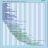 |
| Coastal sea level (tide) | Deviation of sea level from local references in coastal zones, caused by local currents and tides (astronomical and wind-induced) - Measuring units cm, Uncertainty units cm | 0 instruments | |
| Ocean dynamic topography | Deviation of sea level from the geoid caused by ocean currents (that is after corrections for tides and atmospheric pressure effects) - Physical unit: [ cm ] - Accuracy unit: [ cm ]. | 14 instruments | |
| Ocean surface currents (vector) | Water flow on ocean surface - Physical unit: [ cm/s ] - Accuracy unit: [ cm/s ] intended as vector error, i.e. the module of the vector difference between the observed vector and the true vector - Measuring Units cm/s, Uncertainty Units cm/s | 8 instruments | |
| Ocean velocity | Ocean motion measured at various depth levels - Measuring and Uncertainty Units cm/s | 1 instrument | |
| Sea level | Actual, local sea level inclusive of mean sea level and perturbations (tides, etc.) [Unit of measurement - cm] | 18 instruments | |
|