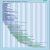
| Instrument | Status/
Accuracy | Instrument Description | Measurement Technology | Timeline |
| ALT | Operational | Global ocean topography, sea level and gravity field measurements. | Radar altimeter |  |
| AMR | Operational | Altimeter data to correct for errors caused by water vapour and cloud-cover. Also measures total water vapour and brightness temperature. | n/a |  |
| AMR-C | Operational | Capabilities of the AMR with the addition of an on-board calibrator for high stability wet-tropospheric path delay correction. | n/a |  |
| AMR-S | Operational | Capabilities of the AMR with the addition of a 2nd beam to provide wet-tropospheric path delay correction within both swaths of the primary radar instrument (KaRIn) | n/a |  |
| GPSP | Operational | Precision orbit determination. | n/a |  |
| Ka-band Radar Interferometer (KaRIn) | Operational | Swath mapping radar altimeter that provides measurements for surface water. | Radar altimeter |  |
| LRA | Operational | Baseline tracking data for precision orbit determination and/or geodesy. Also for calibration of radar altimeter bias. Several types used on various missions. (ASI involved in LAGEOS 2 development). | n/a |  |
| Poseidon-4 Altimeter | Operational | Nadir viewing sounding radar for provision of real-time high-precision sea surface topography, ocean circulation and wave height data. | Radar altimeter |  |
| SAR (RADARSAT-2) | Operational | All-weather images of ocean, ice and land surfaces. Used for monitoring of coastal zones, polar ice, sea ice, sea state, geological features, vegetation and land surface processes. | n/a |  |
| SAR (RCM) | Operational | All-weather, C-band data to support ecosystem monitoring, maritime surveillance and disaster management. | n/a |  |
| SRAL | Operational | Marine and land services. | Radar altimeter |  |
| AMR-CR | Approved | Capabilities of the AMR with the addition of an on-board calibrator for high stability wet-tropospheric path delay correction and a redesign with respect to AMR-C (i.e. the 3 high res MW radiometer channels at 90, 130 and 166 GHz are an integral subsystem of the instrument and not experimental as in AMR-C) | n/a |  |
| IRIS | Approved | Ku-band Interferometric Synthetic Aperture Radar Altimeter (with added Ka-band channel for snow depth retrieval and in combination with AMR-CR MW Radiometer for ice&snow classification and wet troposphere correction) to cover the needs for continuous monitoring of sea ice
thickness and land ice elevation measurement after Cryosat-2, with enhanced performance. | Radar altimeter |  |
| Poseidon-5 Altimeter | Proposed | Nadir viewing sounding radar for provision of real-time high-precision sea surface topography, ocean circulation and wave height data. | Radar altimeter |  |