Automatic Identification System (AIS) vessel data
Measurement Instruments
Measurements > Ocean > Multi-purpose imagery (ocean) > Automatic Identification System (AIS) vessel data
 vessel data Timeline")
Measurement Definition: Ship identification, location, and navigation parameters (including heading, course, and speed) broadcast by vessels via the AIS for maritime safety and situational awareness. Measuring Units and Uncertainty: Multi-parameter information vector: includes location (degrees lat/lon, +/-10–100 m), heading (degrees, +/-1–5 degrees), course (degrees, +/-0.1 degrees), time (seconds) and vessel identification (string, operator-entered).
| Instrument | Status/
Accuracy | Instrument Description | Measurement Technology | Timeline |
| AIS | Operational | Reception of VHF AIS (Automatic Identification System). | n/a | 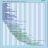 |
| AIS | Operational | Automated location and tracking of vessels | n/a | |
| AIS | Operational | Maritime Traffic Monitoring to augment Synthetic Aperture Radar Maritime services | n/a | |
| AIS (RCM) | Operational | Ship identification (name, location, heading, cargo, etc). | n/a | |
| AIS Receiver (MDASat-1) | Operational | MDASat-1 is equipped with an upgraded AIS receiver from its predecessor, ZACube-2. It will be capable of detecting AIS and AIS-LR messages. Additionally, it has the ability to capture raw data in the maritime spectrum which opens up the possibility to perform diagnostic testing to assess signal interference conditions in the band and their effect on the decoding of messages. | n/a | |
| SPAISE2 (AIS) | Operational | Ship identification (name, location, heading, cargo, etc). | n/a | |
| SPAISE3 (AIS) | Operational | Ship identification (name, location, heading, cargo, etc). | n/a | |