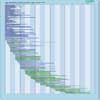
| Instrument | Status/
Accuracy | Instrument Description | Measurement Technology | Timeline |
| ABI | Operational | Detects clouds, cloud properties, water vapour, land and sea surface temperatures, dust, aerosols, volcanic ash, fires, total ozone, snow and ice cover, vegetation index. | Multi-purpose imaging Vis/IR radiometer |  |
| Imager | Operational | Measures cloud cover, atmospheric radiance, winds, atmospheric stability, rainfall estimates. Used to provide severe storm warnings/ monitoring day and night (type, amount, storm features). | Multi-purpose imaging Vis/IR radiometer |  |
| MODIS | Operational | Data on biological and physical processes on the surface of the Earth and in the lower atmosphere, and on global dynamics. Surface temperatures of land and ocean, chlorophyll fluorescence, land cover measurements, cloud cover (day and night). | n/a |  |
| OLI | Operational | Measures surface radiance, land cover state, and change (e.g., vegetation type). Used as multi-purpose imagery for land applications. | n/a |  |
| OLI-2 | Operational | Measures surface radiance, land cover state, and change (e.g., vegetation type). Used as multi-purpose imagery for land applications. | n/a |  |
| SLSTR | Operational | Marine and land services. | n/a |  |
| TIRS | Operational | Measures longwave thermal infrared surface emittance, land cover state, and change. Used as multipurpose imagery for land applications. | n/a |  |
| TIRS-2 | Operational | Measures longwave thermal infrared surface emittance, land cover state, and change. Used as multipurpose imagery for land applications. TIRS-2 will adhere to the Landsat 8 TIRS instrument performance specifications but will be built to NASA Class-B instrument standards (including a 5-year design life). | n/a |  |
| VIIRS | Operational | Global observations of land, ocean, and atmosphere parameters: cloud/weather imagery, sea-surface temperature, ocean colour, land surface vegetation indices. | Multi-purpose imaging Vis/IR radiometer |  |
| CWFMS | Being developed | Measurements are: Fire Radiative Power (FRP), hotspot locations, rate of spread, burned area mapping. Data products generated: 1) Fire maps, showing location, extent, and timing of forest fire events; 2) Fire characteristics, such as fire line intensity, rate of spread and fuel consumption; 3) Plume dynamics through smoke transport maps and plume heights; 4) Mass of carbon released into atmosphere. | Multi-purpose imaging Vis/IR radiometer |  |
| GXI | Being developed | Detects clouds, cloud properties, water vapour, land and sea surface temperatures, dust, aerosols, volcanic ash, fires, total ozone, snow and ice cover, vegetation index. | Multi-purpose imaging Vis/IR radiometer |  |
| TIR | Being developed | 1) Ecosystem stress and water use (i.e. monitoring of energy and water budgets of the continental biosphere);2) Urban (i.e. climatology and monitoring of fluxes of urban surfaces); 3) Sea Surface Temperature on approximately 200km coastal band. | n/a |  |
| ASLSTR | Proposed | Dual-view conical scanner with channels in the VIS, NIR SWIR TIR, supporting a wide range of Marine, Land, Atmosphere and Climate Services. Provides enhanced continutity of SST and LST measurements from SLSTR and enhanced synergy with AOLCI | Multi-purpose imaging Vis/IR radiometer |  |
| LandIS | Proposed | Measures surface radiance, land cover state and change (e.g., vegetation type), and longwave termal infrared surface emittance. Used as multi-purpose imagery for land applications. | n/a |  |