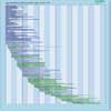
| Instrument | Status/
Accuracy | Instrument Description | Measurement Technology | Timeline |
| AVHRR/3 | Operational | Measurements of land and sea surface temperature, cloud cover, snow and ice cover, soil moisture and vegetation indices. Data also used for volcanic eruption monitoring. | Multi-purpose imaging Vis/IR radiometer |  |
| AWiFS | Operational | Vegetation and crop monitoring, resource assessment (regional scale), forest mapping, land cover/ land use mapping, and change detection. | Multi-purpose imaging Vis/IR radiometer |  |
| HSI-2 (HJ-2A) | Operational | Hyperspectral measurements for environment and disaster management operations. | Multi-purpose imaging Vis/IR radiometer |  |
| LISS-III (Resourcesat) | Operational | Data used for vegetation type assessment, resource assessment, crop stress detection, crop production forecasting, forestry, land use and land cover change. | High resolution optical imager |  |
| MERSI-2 | Operational | Measurement of vegetation indexes and ocean colour. | Multi-purpose imaging Vis/IR radiometer |  |
| MERSI-3 | Operational | Measurement of vegetation indexes and ocean colour. | Multi-purpose imaging Vis/IR radiometer |  |
| METimage | Operational | Operational multi spectral imager for meteorological EPS-SG VIS/IR Imaging Mission (VII): imagery data for global and regional NWP, NWC, and climate monitoring with information on LST, SST, clouds coverage, height and micro-physics, land surfaces (vegetation, snow/ice, fire), water vapour column, aerosol and atmospheric motion vectors. Provides collocated cloud mask, height & characterisation as well as intra-pixel heterogeneity to other EPS-SG missions (with larger footprint). | Multi-purpose imaging Vis/IR radiometer |  |
| MISR | Operational | Measurements of global surface albedo, aerosol and vegetation properties. Also provides multi-angle bidirectional data (1% angle-to-angle accuracy) for cloud cover and reflectances at the surface and aerosol opacities. Global and local modes. | n/a |  |
| MODIS | Operational | Data on biological and physical processes on the surface of the Earth and in the lower atmosphere, and on global dynamics. Surface temperatures of land and ocean, chlorophyll fluorescence, land cover measurements, cloud cover (day and night). | n/a |  |
| MSI (Sentinel-2) | Operational | Optical high spatial resolution imagery over land and coastal areas for Copernicus operational services. | High resolution optical imager |  |
| OLCI | Operational | Marine and land services. | n/a |  |
| OLI | Operational | Measures surface radiance, land cover state, and change (e.g., vegetation type). Used as multi-purpose imagery for land applications. | High resolution optical imager |  |
| OLI-2 | Operational | Measures surface radiance, land cover state, and change (e.g., vegetation type). Used as multi-purpose imagery for land applications. | High resolution optical imager |  |
| SGLI | Operational +/-0 | Medium resolution multi-spectral imaging of land, ocean and atmosphere. SGLI-VNR is an optical sensor capable of multi-channel nadir observation at wavelengths from near-UV to NIR and forward or backward polarization observation at red and near infrared wavelengths (Push-broom scanning). SGLI-IRS is an optical sensor capable of multi-channel nadir observation at wavelengths from SWIR to TIR wavelengths (Cross-track scanning). | n/a |  |
| 3MI | Being developed | Measure aerosol parameters, air quality index, surface albedo, cloud information | n/a |  |
| HIS | Being developed | Pushbroom-type dual-prism Imaging Spectrometer with high radiometric accuracy and medium Signal-to-noise Ratio, operating from UV (320 nm) to SWIR (2400 nm) , based on a single MCT Detector/focal plane. The HIS aims at accurate spectral imaging on land and ocean for climatological background radiometric data acquistion and supporting cross-calibration with other stellites/sensors and on PICS/instrumented sites with highest resolution (50 m) | High resolution optical imager |  |
| FLORIS | Approved | Mapping vegetation fluorescence to quantify photosynthetic activity. | n/a |  |
| HSI | Approved | Pushbroom-type grating Imaging Spectrometer with high Signal-to-noise Ratio and data uniformity to derive quantitative surface characteristics supporting the monitoring, implementation and improvement of a range of policies in the domain of raw materials, agriculture, soils, food security, biodiversity, environmental degradation and hazards, inland and coastal waters, snow, forestry and the urban environment | High resolution optical imager |  |
| AMSI | Proposed | Optical high spatial resolution imagery over land and coastal areas for Copernicus operational services. | High resolution optical imager |  |
| AOLCI | Proposed | Visible and near-infrared hyperspectral radiometer supporting a wide range of Marine, Land, Atmosphere and Climate Services. Provides enhanced continutity of ocean colour and land colour measurements from OLCI and enhanced synergy with ASLSTR | n/a |  |
| LandIS | Proposed | Measures surface radiance, land cover state and change (e.g., vegetation type), and longwave termal infrared surface emittance. Used as multi-purpose imagery for land applications. | High resolution optical imager |  |