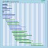
| Instrument | Status/
Accuracy | Instrument Description | Measurement Technology | Timeline |
| CSG SAR | Operational | All-weather images of ocean, land and ice for monitoring of land surface processes, ice, environmental monitoring, risk management, environmental resources, maritime management, Earth topographic mapping. | Imaging radar (SAR) |  |
| OLI | Operational | Measures surface radiance, land cover state, and change (e.g., vegetation type). Used as multi-purpose imagery for land applications. | High resolution optical imager |  |
| OLI-2 | Operational | Measures surface radiance, land cover state, and change (e.g., vegetation type). Used as multi-purpose imagery for land applications. | High resolution optical imager |  |
| SAR (RADARSAT-2) | Operational | All-weather images of ocean, ice and land surfaces. Used for monitoring of coastal zones, polar ice, sea ice, sea state, geological features, vegetation and land surface processes. | Imaging radar (SAR) |  |
| SAR (RCM) | Operational | All-weather, C-band data to support ecosystem monitoring, maritime surveillance and disaster management. | Imaging radar (SAR) |  |
| SAR 2000 | Operational | All-weather images of ocean, land and ice for monitoring of land surface processes, ice, environmental monitoring, risk management, environmental resources, maritime management, Earth topographic mapping. | Imaging radar (SAR) |  |
| SAR-L | Operational | Land, ocean, emergencies, soil moisture, interferometry, others. | Imaging radar (SAR) |  |
| TIRS | Operational | Measures longwave thermal infrared surface emittance, land cover state, and change. Used as multipurpose imagery for land applications. | n/a |  |
| TIRS-2 | Operational | Measures longwave thermal infrared surface emittance, land cover state, and change. Used as multipurpose imagery for land applications. TIRS-2 will adhere to the Landsat 8 TIRS instrument performance specifications but will be built to NASA Class-B instrument standards (including a 5-year design life). | n/a |  |
| WSAR | Operational | High resolution radar measurements of land and ocean features. | Imaging radar (SAR) |  |
| X-Band SAR | Operational | High resolution images for monitoring of land surface and coastal processes and for agricultural, geological and hydrological applications. | Imaging radar (SAR) |  |
| SWIR | Being developed | Monitoring vegetation, water resoruce | n/a |  |
| LandIS | Proposed | Measures surface radiance, land cover state and change (e.g., vegetation type), and longwave termal infrared surface emittance. Used as multi-purpose imagery for land applications. | High resolution optical imager |  |
| L-Band SAR | Proposed | Global observation of dynamic processes in the bio-, cryo-, geo- and hydrosphere. | Imaging radar (SAR) |  |
| PLATiNO TIR | No longer considered | Developed by Leonardo and SITAEL, PLATiNO-2 TIR will acquire images that will be used to provide valuable services for territories control and protection such as monitoring waters, glaciers, pollutants, state of crops and vegetation, energy consumption in urban areas. PLATiNO-2 is also equipped with the magnetically shielded HT 100, an improved version of SITAEL electric thruster, making PLATiNO-2 one of the first missions in the world to observe the Earth in the Thermal Infrared from a very low | n/a |  |