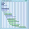
| Instrument | Status/
Accuracy | Instrument Description | Measurement Technology | Timeline |
| AMSR2 | Operational +/-16 cm | Measurements of water vapour, cloud liquid water, precipitation, winds, sea surface temperature, sea ice concentration, snow cover, soil moisture. | Multi-purpose imaging MW radiometer |  |
| AMSR3 | Operational | Measurements of water vapour, cloud liquid water, precipitation including snowfall, winds, sea surface temperature, sea ice concentration, snow cover, soil moisture. | Multi-purpose imaging MW radiometer |  |
| AMSU-A | Operational | All-weather night-day temperature sounding to an altitude of 45 km. | n/a |  |
| AMSU-A | Operational | All-weather night-day temperature sounding to an altitude of 45 km. AMSU-A on Aqua is still partially operational, with 9 of the 15 channels working and collecting data. | n/a |  |
| CSG SAR | Operational | All-weather images of ocean, land and ice for monitoring of land surface processes, ice, environmental monitoring, risk management, environmental resources, maritime management, Earth topographic mapping. | Imaging radar (SAR) |  |
| MWRI-RM | Operational | Multi-purpose imagery with emphasis on precipitation | Multi-purpose imaging MW radiometer |  |
| SAR (RADARSAT-2) | Operational | All-weather images of ocean, ice and land surfaces. Used for monitoring of coastal zones, polar ice, sea ice, sea state, geological features, vegetation and land surface processes. | Imaging radar (SAR) |  |
| SAR (RCM) | Operational | All-weather, C-band data to support ecosystem monitoring, maritime surveillance and disaster management. | Imaging radar (SAR) |  |
| SSM/IS | Operational | Measures thermal microwave radiation. Global measurements of air temp profile, humidity profile, ocean surface winds, rain overland/ocean, ice concentration/age, ice/snow edge, water vapour/clouds over ocean, snow water content, land surface temperature. | Multi-purpose imaging MW radiometer |  |
| Imaging Microwave Radiometer | Approved | A conical scanning total power radiometer operating in 5 bands (L/C/X/K/Ka) to provide high-spatial resolution microwave imaging radiometry measurements and derived products with continuous global coverage and sub-daily revisit in the polar regions and adjacent seas. | Multi-purpose imaging MW radiometer |  |
| L-Band SAR | Approved | L-band SAR instrument offering full polarimetry, high spatial resolution, high sensitivity, low ambiguity ratios and capability for repeat-pass & single-pass cross-track interferometry to measure surface deformation of vegetated terrain, soil moisture, land cover classification, crop type discrimination and its temporal analysis. Furthermore, it will monitor Polar ice sheets and ice caps, and the sea-ice conditions (i.e. type, drift, deformation, concentration, lead fraction), as well as contribute to the European maritime situational awareness. | Imaging radar (SAR) |  |
| AMSR-E | No longer operational +/-20 % | Measurements of water vapour, cloud liquid water, precipitation, winds, sea surface temperature, sea ice concentration, snow cover and soil moisture. Instrument stopped functioning 4th October 2011. | Multi-purpose imaging MW radiometer |  |