Ocean Suspended Sediment Concentration
Measurement Instruments
Measurements > Ocean > Ocean colour/biology > Ocean suspended sediment concentration

Measurement Definition: Parameter extracted from ocean colour observation. Indicative of river outflow, re-suspension or pollution of other-than-biological origin. Requested in both open ocean and coastal zone - Physical unit: [ g/m3 ] - Accuracy unit: [ % ] at a specific concentration (e.g., 2 g/m3).
| Instrument | Status/
Accuracy | Instrument Description | Measurement Technology | Timeline |
| CZI | Operational | Imagery of coastal regions - estuaries, tidal regions, etc. | Multi-purpose imaging Vis/IR radiometer | 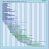 |
| HSI-2 (HJ-2A) | Operational | Hyperspectral measurements for environment and disaster management operations. | Multi-purpose imaging Vis/IR radiometer | |
| MODIS | Operational | Data on biological and physical processes on the surface of the Earth and in the lower atmosphere, and on global dynamics. Surface temperatures of land and ocean, chlorophyll fluorescence, land cover measurements, cloud cover (day and night). | n/a | |
| OCI | Operational | Ocean color slit-grating imaging spectrometer/radiometer for measuring top of atmosphere reflectance which is used to estimate ocean leaving light that contains information on biological components plus aerosol and cloud propertiesl | n/a | |
| OLCI | Operational | Marine and land services. | n/a | |
| SGLI | Operational +/-100 % | Medium resolution multi-spectral imaging of land, ocean and atmosphere. SGLI-VNR is an optical sensor capable of multi-channel nadir observation at wavelengths from near-UV to NIR and forward or backward polarization observation at red and near infrared wavelengths (Push-broom scanning). SGLI-IRS is an optical sensor capable of multi-channel nadir observation at wavelengths from SWIR to TIR wavelengths (Cross-track scanning). | n/a | |
| GLIMR Instrument | Being developed | GLIMR will make observations of rapidly evolving phytoplankton dynamics and hazards such as Harmful Algal Blooms (HABs) and oil spills in the Gulf of Mexico and other selected coastal regions of North and South America | Multi-purpose imaging Vis/IR radiometer | |
| FLORIS | Approved | Mapping vegetation fluorescence to quantify photosynthetic activity. | n/a | |
| VIS-NIR | Approved | Ocean Colour - Open ocean, coastal & in-land waters. | n/a | |
| AOLCI | Proposed | Visible and near-infrared hyperspectral radiometer supporting a wide range of Marine, Land, Atmosphere and Climate Services. Provides enhanced continutity of ocean colour and land colour measurements from OLCI and enhanced synergy with ASLSTR | n/a | |