| CEOS EO HANDBOOK – MEASUREMENT CATEGORIES
|
|
Measurements > Ocean

EO Handbook summary: click here  | Measurements of ocean include a number of parameters covering colour, salinity, temperature, waves, topography, current and winds. | |
| Measurement | Description | Timeline |
| Multi-purpose imagery (ocean) | In addition to the specific ocean measurement observations discussed in previous sections, a number of sensors are capable of providing a range of ocean imagery from which useful secondary applications can be derived. | 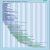 |
| Ocean colour/biology | Remote sensing measurements of ocean colour (i.e. the detection of phytoplankton pigments) provide the only global-scale focus on the biology and productivity of the ocean’s surface layer. Phytoplankton are microscopic plants that live in the ocean, and like terrestrial plants, they contain the pigment chlorophyll, which gives them their greenish colour. Different shades of ocean colour reveal the presence of differing concentrations of sediments, organic materials and phytoplankton. The ocean over regions with high concentrations of phytoplankton is shaded from blue-green to green, depending on the type and density of the phytoplankton population. From space, satellite sensors can distinguish even slight variations in colour which cannot be detected by the human eye. | |
| Ocean Salinity | Ocean salinity measurements are important because surface salinity and temperature control the density and stability of the surface water. Thus, ocean mixing (of heat and gases) and water-mass formation processes are intimately related to variations of surface salinity. Ocean modelling and analysis of water mass mixing should be enabled by new knowledge of surface-density fields derived from surface salinity measurements. The importance of the ocean in the global hydrological cycle also cannot be overstated. Some ocean models show that sufficient surface freshening results in slowing down the meridional overturning circulation, thereby affecting the oceanic transport of heat. | |
| Ocean surface winds | High resolution vector wind measurements at the sea surface are required in models of the atmosphere, ocean surface waves and ocean circulation. They are proving useful in enhancing marine weather forecasting through assimilation into NWP models and in improving understanding of the large-scale air-sea fluxes which are vital for climate prediction purposes. Accurate wind vector data affect a broad range of marine operations, including offshore oil operations, ship movement and routing. Such data also aid short-term weather forecasting and the issue of timely weather warnings. | |
| Ocean topography/currents | Ocean surface topography data contain information that has significant practical applications in such fields as the study of worldwide weather and climate patterns, the monitoring of shoreline evolution and the protection of ocean fisheries. Ocean circulation is of critical importance to the Earth’s climate system. Ocean currents transport a significant amount of energy from the tropics towards the poles, leading to a moderation of the climate at high latitudes. Circulation can be deduced from ocean surface topography, which may be readily measured using satellite altimetry. | |
| Ocean wave height and spectrum | Sea state and wind speed govern air-sea fluxes of momentum, heat, water vapour and gas transfer. The state of the sea and surface pressure are two features of the weather that are important to commercial use of the sea (e.g. ship routing, warnings of hazards to shipping, marine construction, off-shore drilling installations and fisheries). Information on surge height at the coast is key to the protection of life and property in coastal habitats. | |
| Surface temperature (ocean) | Ocean surface temperature (often known as ‘sea surface temperature’ or SST) is one of the most important boundary conditions for the general circulation of the atmosphere. The ocean exchanges vast amounts of heat and energy with the atmosphere and these air/sea interactions have a profound influence on the Earth’s weather and climate patterns. SST is linked closely with the ocean circulation, as demonstrated by the El Niño-Southern Oscillation (ENSO) cycle. | |
|
|
|