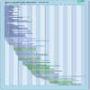
| Instrument | Status/
Accuracy | Instrument Description | Measurement Technology | Timeline |
| ALT | Operational | Global ocean topography, sea level and gravity field measurements. | Radar altimeter |  |
| AltiKa | Operational | Sea surface height. | Radar altimeter |  |
| C-Band SAR | Operational | Marine core services, land monitoring and emergency services. Monitoring sea ice zones and arctic environment. Surveillance of marine environment, monitoring land surface motion risks, mapping of land surfaces (forest, water and soil, agriculture), mapping in support of humanitarian aid in crisis situations. | Imaging radar (SAR) |  |
| POSEIDON-3B Altimeter | Operational | Nadir viewing sounding radar for provision of real-time high precision sea surface topography, ocean circulation and wave height data. | Radar altimeter |  |
| POSEIDON-3C Altimeter | Operational | Nadir viewing sounding radar for provision of real-time high precision sea surface topography, ocean circulation and wave height data. | Radar altimeter |  |
| Poseidon-4 Altimeter | Operational | Nadir viewing sounding radar for provision of real-time high-precision sea surface topography, ocean circulation and wave height data. | Radar altimeter |  |
| SAR (RADARSAT-2) | Operational | All-weather images of ocean, ice and land surfaces. Used for monitoring of coastal zones, polar ice, sea ice, sea state, geological features, vegetation and land surface processes. | Imaging radar (SAR) |  |
| SAR (RCM) | Operational | All-weather, C-band data to support ecosystem monitoring, maritime surveillance and disaster management. | Imaging radar (SAR) |  |
| SRAL | Operational | Marine and land services. | Radar altimeter |  |
| SWIM | Operational | Ku-band Real-aperture radar (RAR) system, multi-incindence beams(0-10°) and azimuth scanning. Measurement of 2D ocean waves spectrum | n/a |  |
| SGR-ReSI-Z | Being developed | Ocean winds, waves, soil moisture, flooding, freeze / thaw state over permafrost, biomass, ice, snow | n/a |  |
| IRIS | Approved | Ku-band Interferometric Synthetic Aperture Radar Altimeter (with added Ka-band channel for snow depth retrieval and in combination with AMR-CR MW Radiometer for ice&snow classification and wet troposphere correction) to cover the needs for continuous monitoring of sea ice
thickness and land ice elevation measurement after Cryosat-2, with enhanced performance. | Radar altimeter |  |
| L-Band SAR | Approved | L-band SAR instrument offering full polarimetry, high spatial resolution, high sensitivity, low ambiguity ratios and capability for repeat-pass & single-pass cross-track interferometry to measure surface deformation of vegetated terrain, soil moisture, land cover classification, crop type discrimination and its temporal analysis. Furthermore, it will monitor Polar ice sheets and ice caps, and the sea-ice conditions (i.e. type, drift, deformation, concentration, lead fraction), as well as contribute to the European maritime situational awareness. | Imaging radar (SAR) |  |
| Poseidon-5 Altimeter | Proposed | Nadir viewing sounding radar for provision of real-time high-precision sea surface topography, ocean circulation and wave height data. | Radar altimeter |  |
| SAOOH | Proposed | Interferometric swath altimeter building on the heritage of the SWOT mission. It will enhance sampling coverage and performance of hydrology water surface elevation measurements. | Radar altimeter |  |