Geoid
Measurement Instruments
Measurement Definition: Equipotential surface which would coincide exactly with the mean ocean surface of the Earth, if the oceans were in equilibrium, at rest, and extended through the continents (such as with very narrow channels) - Physical unit: [ cm ] - Accuracy unit: [ cm ].
| Instrument | Status/
Accuracy | Instrument Description | Measurement Technology | Timeline |
| DGXX-S | Operational | Precise orbit determination; Real time onboard orbit determination (navigation). The main changes from previous versions of DORIS are the change of DORIS antenna location for compliance with each potential launch vehicle; improvement in modeling the Solar Panels position; new data in Telemetry allowing "pole product" generation. | n/a | 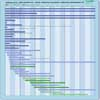 |
| POSEIDON-3B Altimeter | Operational | Nadir viewing sounding radar for provision of real-time high precision sea surface topography, ocean circulation and wave height data. | Radar altimeter | |
| POSEIDON-3C Altimeter | Operational | Nadir viewing sounding radar for provision of real-time high precision sea surface topography, ocean circulation and wave height data. | Radar altimeter | |
| Poseidon-4 Altimeter | Operational | Nadir viewing sounding radar for provision of real-time high-precision sea surface topography, ocean circulation and wave height data. | Radar altimeter | |
| SRAL | Operational | Marine and land services. | Radar altimeter | |
| STR | Operational | Precise attitude determination from the combination of two or three star trackers. | n/a | |
| LTI | Approved | The aim of MAGIC is to obtain high-resolution measurements in space and time and include the capability to determine the variations in gravity field due to mass change in hydrology, cryosphere, oceanography, solid Earth and climate change signals so as to serve science and operational products including emergency services. | n/a | |
| Poseidon-5 Altimeter | Proposed | Nadir viewing sounding radar for provision of real-time high-precision sea surface topography, ocean circulation and wave height data. | Radar altimeter | |