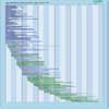
| Instrument | Status/
Accuracy | Instrument Description | Measurement Technology | Timeline |
| CSG SAR | Operational | All-weather images of ocean, land and ice for monitoring of land surface processes, ice, environmental monitoring, risk management, environmental resources, maritime management, Earth topographic mapping. | Imaging radar (SAR) |  |
| GSA (1) | Operational | Land surface monitoring | n/a |  |
| MSI (Sentinel-2) | Operational | Optical high spatial resolution imagery over land and coastal areas for Copernicus operational services. | High resolution optical imager |  |
| SAR (RADARSAT-2) | Operational | All-weather images of ocean, ice and land surfaces. Used for monitoring of coastal zones, polar ice, sea ice, sea state, geological features, vegetation and land surface processes. | Imaging radar (SAR) |  |
| SAR (RCM) | Operational | All-weather, C-band data to support ecosystem monitoring, maritime surveillance and disaster management. | Imaging radar (SAR) |  |
| SAR 2000 | Operational | All-weather images of ocean, land and ice for monitoring of land surface processes, ice, environmental monitoring, risk management, environmental resources, maritime management, Earth topographic mapping. | Imaging radar (SAR) |  |
| VIIRS | Operational | Global observations of land, ocean, and atmosphere parameters: cloud/weather imagery, sea-surface temperature, ocean colour, land surface vegetation indices. | n/a |  |
| AMSI | Being developed | Optical high spatial resolution imagery over land and coastal areas for Copernicus operational services. | High resolution optical imager |  |
| HSI | Being developed | Pushbroom-type grating Imaging Spectrometer with high Signal-to-noise Ratio and data uniformity to derive quantitative surface characteristics supporting the monitoring, implementation and improvement of a range of policies in the domain of raw materials, agriculture, soils, food security, biodiversity, environmental degradation and hazards, inland and coastal waters, snow, forestry and the urban environment | High resolution optical imager |  |
| Land Surface Temperature Radiometer | Being developed | VNIR/SWIR/TIR radiometer with three independent focal planes fed by a single telescope to acquire images of all land and coastal areas with high radiometric accuracy and spatial resolution. Acquistion are during day and night in TIR bands and during day in VNIR/SWIR bands.
Monitoring evapotranspiration (ET) rate at European field scale by capturing the variability of Land Surface Temperature (LST) (and hence ET) enabling more robust estimates of field-scale water productivity. Supporting a range of additional services benefitting from TIR observations (e.g. soil composition, coastal zone management, High-Temperature Events (HTE), urban heat islands). | n/a |  |
| P-Band SAR | Being developed | Forest biomass monitoring. Products are Forest Above Ground Biomass, Forest height and Forest Distrubance. | Imaging radar (SAR) |  |