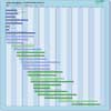
| Instrument | Status/
Accuracy | Instrument Description | Measurement Technology | Timeline |
| ASCAT | Operational | Measures wind speed and direction over ocean, soil moisture, sea ice cover, sea ice type, snow cover and snow parameters and vegetation parameters | Radar scatterometer |  |
| BRLK S-range | Operational | Disaster monitoring, sea surface monitoring, information support of environmental managment | Imaging radar (SAR) |  |
| C-Band SAR | Operational | Marine core services, land monitoring and emergency services. Monitoring sea ice zones and arctic environment. Surveillance of marine environment, monitoring land surface motion risks, mapping of land surfaces (forest, water and soil, agriculture), mapping in support of humanitarian aid in crisis situations. | Imaging radar (SAR) |  |
| CSG SAR | Operational | All-weather images of ocean, land and ice for monitoring of land surface processes, ice, environmental monitoring, risk management, environmental resources, maritime management, Earth topographic mapping. | Imaging radar (SAR) |  |
| GSA (1) | Operational | Land surface monitoring | n/a |  |
| PALSAR-2 | Operational | Disaster monitoring, land monitoring, agricultural monitoring, natural resource exploration, global forest monitoring, potential use and interferometry. | Imaging radar (SAR) |  |
| PALSAR-3 | Operational | Disaster monitoring, land monitoring, agricultural monitoring, natural resource exploration, global forest monitoring, potential use and interferometry. | Imaging radar (SAR) |  |
| SAR (RADARSAT-2) | Operational | All-weather images of ocean, ice and land surfaces. Used for monitoring of coastal zones, polar ice, sea ice, sea state, geological features, vegetation and land surface processes. | Imaging radar (SAR) |  |
| SAR (RCM) | Operational | All-weather, C-band data to support ecosystem monitoring, maritime surveillance and disaster management. | Imaging radar (SAR) |  |
| SAR 2000 | Operational | All-weather images of ocean, land and ice for monitoring of land surface processes, ice, environmental monitoring, risk management, environmental resources, maritime management, Earth topographic mapping. | Imaging radar (SAR) |  |
| SAR-L | Operational | Land, ocean, emergencies, soil moisture, interferometry, others. | Imaging radar (SAR) |  |
| Severyanin-M | Operational | Land and sea surface monitoring | Imaging radar (SAR) |  |
| VIIRS | Operational | Global observations of land, ocean, and atmosphere parameters: cloud/weather imagery, sea-surface temperature, ocean colour, land surface vegetation indices. | n/a |  |
| WSAR | Operational | High resolution radar measurements of land and ocean features. | Imaging radar (SAR) |  |
| X-Band SAR | Operational | High resolution images for monitoring of land surface and coastal processes and for agricultural, geological and hydrological applications. | Imaging radar (SAR) |  |
| MWI | Being developed | Measure cloud liquid water content, solid/liquid precipitation information, total column water vapour and temperature profiles, sea ice parameters, sea surface temperature, sea surface wind speed. | Multi-purpose imaging MW radiometer |  |
| SCA | Being developed | Measures wind speed and direction over ocean, soil moisture, sea ice cover, sea ice type, snow cover and snow parameters and vegetation parameters | Radar scatterometer |  |
| Imaging Microwave Radiometer | Approved | A conical scanning total power radiometer operating in 5 bands (L/C/X/K/Ka) to provide high-spatial resolution microwave imaging radiometry measurements and derived products with continuous global coverage and sub-daily revisit in the polar regions and adjacent seas. | Multi-purpose imaging MW radiometer |  |
| Kasatka-R | Approved | Disaster monitoring, sea surface monitoring, information support of environmental managment | Imaging radar (SAR) |  |
| L-Band SAR | Approved | L-band SAR instrument offering full polarimetry, high spatial resolution, high sensitivity, low ambiguity ratios and capability for repeat-pass & single-pass cross-track interferometry to measure surface deformation of vegetated terrain, soil moisture, land cover classification, crop type discrimination and its temporal analysis. Furthermore, it will monitor Polar ice sheets and ice caps, and the sea-ice conditions (i.e. type, drift, deformation, concentration, lead fraction), as well as contribute to the European maritime situational awareness. | Imaging radar (SAR) |  |
| L-Band SAR | Proposed | Global observation of dynamic processes in the bio-, cryo-, geo- and hydrosphere. | Imaging radar (SAR) |  |
| Advanced SAR | No longer considered | High resolution microwave radar images for ice watch. | Imaging radar (SAR) |  |