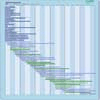
| Instrument | Status/
Accuracy | Instrument Description | Measurement Technology | Timeline |
AIRS
Atmospheric Infra-red Sounder | Operational
| High spectral resolution measurement of temperature and humidity profiles in the atmosphere. Long-wave Earth surface emissivity. Cloud diagnostics. Trace gas profiles. Surface temperatures. | Medium-resolution IR spectrometer |  |
AMSU-A
Advanced Microwave Sounding Unit-A | Operational
| All-weather night-day temperature sounding to an altitude of 45 km. | n/a |  |
AMSU-A
Advanced Microwave Sounding Unit-A | Operational
| All-weather night-day temperature sounding to an altitude of 45 km. AMSU-A on Aqua is still partially operational, with 9 of the 15 channels working and collecting data. | n/a |  |
ASTER
Advanced Spaceborne Thermal Emission and Reflection Radiometer | Operational
| Surface and cloud imaging with high spatial resolution, stereoscopic observation of local topography, cloud heights, volcanic plumes, and generation of local surface digital elevation maps. Surface temperature and emissivity. ASTER SWIR detectors are no longer functioning due to anomalously high SWIR detector temperatures. ASTER SWIR data acquired since April 2008 are not useable, and show saturation of values and severe striping. All attempts to bring the SWIR bands back to life have failed, and no further action is envisioned. | n/a |  |
CERES
Cloud and the Earth's Radiant Energy System | Operational
| Long term measurement of the Earth's radiation budget and atmospheric radiation from the top of the atmosphere to the surface; provision of an accurate and self-consistent cloud and radiation database. | n/a |  |
ETM+
Enhanced Thematic Mapper Plus | Operational
| Measures surface radiance and emittance, land cover state, and change (e.g., vegetation type). Used as multi-purpose imagery for land applications. | n/a |  |
GMI
GPM Microwave Imager | Operational
| Measures rainfall rates over oceans and land, combined rainfall structure and surface rainfall rates with associated latent heating. Used to produce three hour, daily, and monthly total rainfall maps over oceans and land. | n/a |  |
IASI
Infrared Atmospheric Sounding Interferometer | Operational
| Measures tropospheric moisture and temperature, column integrated contents of ozone, carbon monoxide, methane, nitrous oxide and other minor gases which affect tropospheric chemistry. Also measures sea surface and land temperature. | Medium-resolution IR spectrometer |  |
IRMSS-2 (HJ-2)
Infrared Multispectral Scanner - 2 | Operational
| Infrared measurements for environment and natural disaster monitoring. | n/a |  |
MODIS
MODerate-Resolution Imaging Spectroradiometer | Operational
| Data on biological and physical processes on the surface of the Earth and in the lower atmosphere, and on global dynamics. Surface temperatures of land and ocean, chlorophyll fluorescence, land cover measurements, cloud cover (day and night). | n/a |  |
OLI
Operational Land Imager | Operational
| Measures surface radiance, land cover state, and change (e.g., vegetation type). Used as multi-purpose imagery for land applications. | n/a |  |
OLI-2
Operational Land Imager 2 | Operational
| Measures surface radiance, land cover state, and change (e.g., vegetation type). Used as multi-purpose imagery for land applications. | n/a |  |
TIRS
Thermal Infrared Sensor | Operational
| Measures longwave thermal infrared surface emittance, land cover state, and change. Used as multipurpose imagery for land applications. | Narrow-band channel IR radiometer |  |
TIRS-2
Thermal Infrared Sensor 2 | Operational
| Measures longwave thermal infrared surface emittance, land cover state, and change. Used as multipurpose imagery for land applications. TIRS-2 will adhere to the Landsat 8 TIRS instrument performance specifications but will be built to NASA Class-B instrument standards (including a 5-year design life). | Narrow-band channel IR radiometer |  |
CWFMS
Canadian Wildland Fire Monitoring Sensor | Being developed
| Measurements are: Fire Radiative Power (FRP), hotspot locations, rate of spread, burned area mapping. Data products generated: 1) Fire maps, showing location, extent, and timing of forest fire events; 2) Fire characteristics, such as fire line intensity, rate of spread and fuel consumption; 3) Plume dynamics through smoke transport maps and plume heights; 4) Mass of carbon released into atmosphere. | n/a |  |
Fourier Transform Spectrometer
Fourier Transform Spectrometer | Approved
| Measure across Earth’s entire far-infrared part of the electromagnetic spectrum | n/a |  |
LandIS
Landsat Next Instrument Suite | Proposed
| Measures surface radiance, land cover state and change (e.g., vegetation type), and longwave termal infrared surface emittance. Used as multi-purpose imagery for land applications. | n/a |  |